How Utah Property Disputes Get More Complicated Than a Boundary Line
Property disputes can involve boundaries, easements, title records, agreements, access, repairs, and neighbor communications. Learn what to gather.
That is common in Davis County property conflicts. A Utah property dispute may involve a deed, legal description, recorded plat, survey, easement, driveway or utility access, maintenance duties, HOA records, a lease or contract, photographs, and years of communication. The line on the ground may be only one part of the problem.
My first question is not who is right. It is which records show the boundary, access, agreement, and history. Start by preserving the property record and the communication history. Do not move a fence, block access, remove property, sign a boundary agreement, or assume a county map decides who is right. The first useful step is to identify what each document shows and what still requires survey, title, or legal review.
- What does the current deed and legal description say?
- Is there a recorded plat, easement, covenant, property-line adjustment, or other instrument?
- Has a licensed surveyor done field work, or are you looking only at a tax or parcel map?
- Does the conflict involve access, drainage, utilities, repairs, maintenance, an HOA, a lease, or a contract?
- What photographs, messages, invoices, and witness information show how the property has been used?
- What practical result are you trying to reach without making the dispute harder to unwind?
Why can a Utah property dispute be about more than the line on the ground?
A visible line can be misleading. A fence may have been installed for convenience rather than on a surveyed boundary. Landscaping may have changed over time. A driveway may cross one parcel while serving another. A utility line, irrigation feature, retaining wall, shared lane, or drainage path may create questions that are different from ownership of the strip itself.
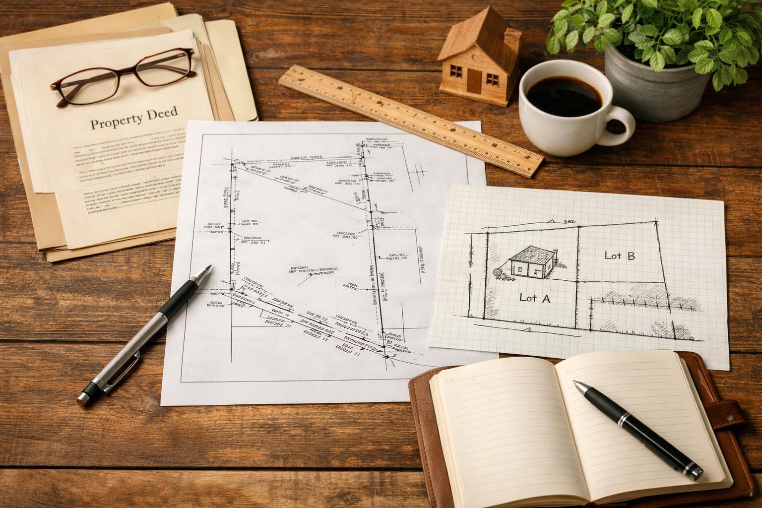
The paperwork can tell several stories at once. A deed identifies the interest transferred and may include a legal description. A recorded plat can show lots, streets, and dedicated areas. A recorded easement may address access or utilities. A title report may list exceptions and recorded interests. A survey may place physical features in relation to the legal description. None of those should be reduced to one cropped image or one sentence.
The relationship history matters too. Neighbors may have discussed a fence, snow removal, shared repairs, parking, landscaping, access, or cost sharing. A landlord and tenant may have a lease. A business may have a purchase agreement, construction contract, or maintenance arrangement. An HOA may have declarations, rules, architectural approvals, meeting records, or violation notices.
That does not mean every conversation creates a legal right. It means the dispute cannot be evaluated honestly without the full record. An old text saying “use the driveway anytime” may be relevant to the history, but it does not by itself establish the existence, scope, duration, or enforceability of an easement. A fence that stood for years may matter factually, but this article does not decide a boundary-by-acquiescence or adverse-possession claim.
Start by naming the practical problem. Is someone blocking access? Is there disagreement about where a fence belongs? Who pays for a retaining wall? Can a utility cross the property? Was a repair promised? Is an HOA or lease term being invoked? Is a sale, refinance, permit, or construction project exposing an old inconsistency?
A clear problem statement helps a Utah property dispute attorney identify which records are likely to matter. “The fence is wrong” is a conclusion. “The 2024 survey pins appear east of the existing fence, the deed uses a different legal description than the parcel map, and the parties disagree about driveway access” gives the reviewer something concrete to investigate.
Source basis: the local-record discussion follows the official Davis County Recorder Property Search and the Davis County Surveyor. The litigation-process discussion follows the Utah Courts summary of civil procedures. County records and process summaries are starting points; they do not establish a boundary, interpret an easement, select a claim, or decide who is right.
Physical condition
Examples: fence, gate, driveway, retaining wall, landscaping, utility line, drainage, or survey marker.
Question: What exists on the ground, and when did it appear?
Recorded record
Examples: deed, plat, easement, lien, covenant, property-line adjustment, or other recorded instrument.
Question: What document trail can be located and read in full?
Private agreement
Examples: lease, maintenance agreement, purchase contract, HOA approval, email, text, or oral discussion.
Question: What was promised, by whom, and is there a complete written record?
Practical remedy
Examples: clarified access, survey work, repair plan, cost allocation, written agreement, stopped conduct, or court ruling.
Question: What result would actually solve the property problem?
Which deeds, plats, easements, title records, and surveys should you gather?
Begin with the deed by which the current owner acquired the property. Keep every page, exhibit, attachment, and legal description. If there are prior deeds in the chain, collect them too when they are available. Do not assume the county tax description, postal address, and legal description are interchangeable.
Look for recorded plats, subdivision maps, condominium records, property-line adjustments, rights-of-way, easements, covenants, mortgages, liens, and releases. The Davis County Recorder records, stores, indexes, preserves, and provides access to real-property documents. Its search tools can help identify the parcel and document trail, but locating a record is not the same as interpreting its legal effect.
Collect title material connected to a purchase, refinance, or proposed sale. That may include a title commitment, policy, exception schedule, closing package, survey endorsement, or correspondence about a title concern. Keep the whole document. A list of exceptions without the referenced instruments can leave the central question unanswered.
Gather every survey or map you have. Identify who prepared it, the date, the license information if shown, the property addressed, and whether it appears to be a field survey, record-of-survey map, site plan, appraisal sketch, assessor map, online parcel image, or owner-created drawing. Those are not the same thing.
Preserve HOA or community-association material if it touches the issue. Include declarations, bylaws, rules, architectural approvals, plats, meeting minutes, notices, maintenance provisions, and correspondence. Do not assume an HOA record controls title or boundary questions; it may instead clarify approvals, shared obligations, or the history of the dispute.
For rental or commercial property, gather the lease, amendments, exhibits, site plans, maintenance terms, notices, repair requests, invoices, and property-management communications. A property conflict can also be a contract dispute when the disagreement concerns what a written agreement requires.
Create a document index with five columns: date, document title, recording or reference number, parties, and why it may matter. Keep “why it may matter” factual. “Shows a 12-foot access strip on Exhibit B” is better than “proves my neighbor is trespassing.”
| Record type | What it may show | What to verify | What it does not decide alone |
|---|---|---|---|
| Deed and legal description | The interest transferred and the property description used in the recorded instrument. | Complete pages, exhibits, recording data, dates, grantor and grantee, and description language. | The on-the-ground location of every line, access right, or physical feature. |
| Plat or county parcel record | Lot, parcel, subdivision, street, ownership, or recorded-document references. | Whether it is a recorded plat, informational parcel map, tax record, or another type of image. | A conclusive legal boundary or title determination. |
| Easement or covenant | Recorded language about access, utilities, maintenance, restrictions, or other property interests. | Full instrument, referenced exhibits, parties, scope language, amendments, and releases. | Validity, current scope, abandonment, enforcement, or application to the present facts. |
| Survey | Field measurements, monuments, legal-description analysis, and relationship of improvements to lines. | Surveyor, date, purpose, property, methods, certifications, and whether later work exists. | Every legal claim or the final resolution of a title dispute. |
| Private agreement or HOA record | Promised use, maintenance, cost sharing, approvals, notices, or historical understanding. | Signatures, complete terms, attachments, dates, authority, and later changes. | Enforceability, ownership, easement rights, or a guaranteed remedy. |
What can the Davis County Recorder and Surveyor tell you – and what can they not decide?
The Davis County Recorder is the public starting point for recorded real-property documents. The county’s Property Search can be used by owner name, property address, parcel or serial number, or document entry number. The search may provide ownership records, recorded deeds, mortgages, liens, legal descriptions, acreage, and parcel information.
That is useful for locating the paper trail. It is not a legal opinion. The Recorder helps people find records and parcels, but it does not provide legal counsel or decide what a document means in a dispute. A recorded instrument can contain technical language, exceptions, references to older documents, or descriptions that require title, survey, and legal analysis.
The public property-search system is also informational. A parcel image or ownership display may be current enough to help locate records, yet it should not be copied into a deed or treated as a surveyed boundary. The county itself warns that property information may not be suitable for legal documents and that title verification may be necessary.
The Davis County Surveyor maintains public survey-related records, including maps of survey, road records, subdivisions, condominiums, partitions, and property-line adjustments. That record library can help identify whether prior survey work or filed mapping exists.
The County Surveyor does not perform a private-property survey except by court order. New field work for a private owner is performed by a licensed surveyor. That distinction matters when a person expects the county to come out, place a line, or tell two owners which fence is correct.
The Recorder and Surveyor are both located in the Davis County Administration Building at 61 South Main Street in Farmington, in different suites. That local detail may make record collection easier, but it does not determine venue or the legal effect of any document.
When you contact a county office, ask a record-location question rather than a legal question. “How can I obtain Instrument 2024-12345?” is within the record search. “Does this easement allow my neighbor to park here?” requires legal interpretation.
Keep copies exactly as obtained. Preserve the recording stamp, entry number, exhibit pages, and source. If a document refers to another instrument, add that referenced instrument to your request list. Property disputes often become confusing because one person reads a summary while another is relying on an attachment that was never collected.
How can photos, repair records, messages, and informal agreements change the picture?
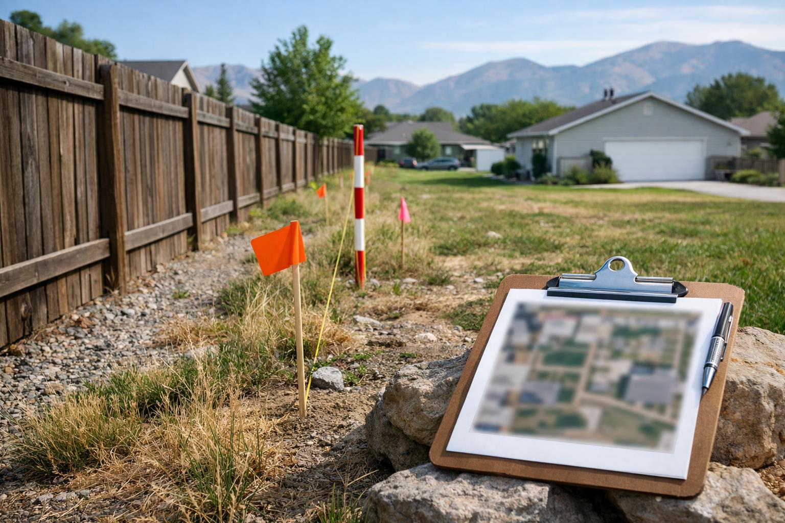
The physical history can explain why the dispute emerged. Create a dated photo folder showing the fence, driveway, gate, wall, drainage area, landscaping, utility equipment, structures, survey flags, and other relevant features. Include wide views and detail views. Do not enter another person’s land or move a marker to improve the photograph.
Preserve older photographs too. Closing photographs, listing images, construction progress, permit photos, inspection reports, family photos, and street-view captures already in your records may show when a feature appeared. Record the source and date when known. Do not alter or annotate the only original.
Collect invoices, bids, receipts, permits, work orders, and contractor communications for disputed repairs or improvements. A retaining wall, fence, drainage project, driveway repair, or utility work can involve who requested the work, who paid, what was represented, and where the work was placed.
Keep complete message threads. Texts and emails may address permission, temporary access, maintenance, cost sharing, objections, proposed fixes, or notice of a problem. Preserve the sender, recipient, date, attachments, and surrounding conversation. A single line taken out of context can be misleading.
If there was an oral discussion, write a neutral memory note now. State the approximate date, location, participants, subject, and what you remember. Separate direct wording from your interpretation. Do not ask the other person to confirm an old agreement in a confrontational message simply to generate evidence.
Witnesses may include prior owners, tenants, neighbors, contractors, property managers, surveyors, HOA representatives, or utility personnel. List what each person may know firsthand. Do not coach them or ask them to adopt your legal conclusion.
Informal agreements can be important, but this article does not say whether an oral agreement is enforceable, whether a text modified a contract, or whether long use created a property right. Those questions can depend on the type of interest, the wording, signatures, authority, recording, statutes, and other facts.
Communication also affects whether a practical resolution remains possible. A record of respectful proposals, specific repair options, and clear objections is easier to evaluate than a chain of public accusations or threats. Preserve the history without turning every message into a legal brief.
When might a licensed surveyor, title review, or legal review be needed?
A licensed surveyor may be needed when the physical location of lines, monuments, improvements, or easement areas must be examined in the field. The surveyor can compare record descriptions with measurements and physical evidence. The scope, product, cost, and timing depend on the property and the question.
Do not order “a survey” without defining the problem. Ask what records the surveyor needs, what area will be examined, whether corners will be set or recovered, what deliverable will be produced, and whether the work addresses the particular fence, access, improvement, or description question.
Title review may be important when the dispute involves the chain of ownership, recorded exceptions, unreleased interests, competing descriptions, easements, covenants, or a proposed transfer. A title commitment, policy, or search can identify records, but the meaning and coverage of those records may still need legal analysis.
Legal review becomes important when you need to understand rights, obligations, claims, defenses, notices, deadlines, remedies, or the effect of an agreement. A lawyer may also help define what question to ask the surveyor or title professional so the work is tied to the dispute rather than ordered in the abstract.
Sometimes all three disciplines are involved. A lawyer identifies the legal question, a title search finds the recorded trail, and a surveyor relates the description to the ground. That does not mean every dispute needs all three. It means one professional should not be asked to perform another professional’s role.
Do not record a new instrument, sign a boundary agreement, grant access, release a claim, move a fence, remove a structure, or block a driveway based only on an online map or informal assurance. The consequences can reach ownership, future buyers, lenders, insurers, tenants, and neighbors.
A Utah civil litigation attorney can review the documents and help identify whether the matter is primarily a property-record question, contract question, access or maintenance problem, negotiation issue, or filed civil dispute. Gibb Law’s Clearfield civil-litigation page provides additional local service context.
Can negotiation or mediation still make sense before court?
Sometimes. The right question is not whether negotiation is always better. It is whether the parties have enough reliable information to discuss a specific problem without putting rights, safety, evidence, or deadlines at risk.
Begin with the practical outcome. Do you need temporary access, a survey, a repair, reimbursement, a maintenance schedule, a clarified boundary, a written easement, stopped conduct, or a clean way to sell or improve the property? Different goals require different documents and decision-makers.
A direct conversation may work when the issue is narrow, both sides can speak calmly, and no order or safety concern limits contact. Keep the communication factual. Identify the document or feature in question, propose a method for obtaining missing information, and avoid threats or admissions written in anger.
A written proposal can help when the parties need clarity. It may identify the disputed area, interim conduct, professional work to be obtained, cost sharing, deadlines for information, or a future meeting. A proposed term is not automatically binding, and a signed agreement may affect property rights in ways that require careful drafting and possible recording.
Mediation can give the parties a structured conversation with a neutral person. It may be useful when the dispute has both legal and practical terms, such as access hours, repair sequencing, cost allocation, landscaping, privacy, or future communication. A mediator does not decide who owns the land or force an agreement.
Litigation may become necessary when formal relief, compulsory information exchange, title resolution, or a court decision is needed. Utah Courts describes civil litigation as a process that can include pleadings, disclosures, discovery, alternative dispute resolution, motions, settlement, and trial preparation. Filing is not one instant courtroom event.
Do not promise that negotiation or mediation will preserve the relationship, save money, avoid court, or produce a result. Do not assume that filing first creates a bargaining advantage. The choice depends on the records, goals, timing, conduct, and available remedies.
Define the property problem
Boundary, access, maintenance, drainage, utility, improvement, HOA, lease, title, or contract question.
Build the record
Deeds, legal descriptions, plats, easements, surveys, title material, photos, invoices, and communications.
Identify the missing professional
County record search, licensed surveyor, title professional, lawyer, mediator, or another qualified reviewer.
Choose a proportionate next step
Information exchange, direct discussion, written proposal, mediation, or civil filing after deadline and risk review.
What should you bring to a Davis County property-dispute consultation?
Bring the current deed, complete legal description, prior deeds you have, recorded plats, easements, covenants, property-line adjustments, title material, surveys, site plans, and county property-search results. Keep recording data and exhibits attached.
Bring the physical record: current and older photographs, a simple site sketch, measurements you personally took labeled as informal, contractor or inspection documents, permits, invoices, bids, and repair records. Do not present an owner sketch as a survey.
Bring the relationship record: complete messages, letters, notices, HOA material, leases, contracts, repair discussions, and any proposed agreement. Include the history before the dispute became hostile, not only the last exchange.
Bring a chronology with dates, events, documents, and people. Note when the property was purchased, when the feature appeared, when access changed, when a survey was performed, when objections were made, and when professional work was requested.
Bring a witness list identifying what each person may know. Prior owners, contractors, surveyors, property managers, neighbors, HOA representatives, and utility personnel may have different pieces of the history.
Bring your practical goal and limits. Explain what outcome would solve the issue, what interim problem exists, whether a sale or project is pending, and what communication has already occurred. Do not assume the available legal remedy will match the preferred practical result.
You can review Gibb Law’s practice areas and Dustin Gibb’s attorney profile before deciding whether to bring the file in. A useful first meeting should sort the documents, identify missing information, and clarify the options without telling you that a map or fence has already won the dispute.
Frequently asked questions about Davis County property disputes
Does the Davis County parcel map prove where my legal boundary is?
No. The county property-search system is a useful informational starting point, but a parcel map is not a conclusive boundary determination or a substitute for the recorded documents, title review, or a licensed private survey.
What is the difference between a recorded plat and a private survey?
A recorded plat is a filed public document associated with a subdivision, condominium, or another mapped property action. A private survey is professional field and record work performed for a defined property question. The documents may relate to each other, but they are not interchangeable.
Can the County Recorder tell me whether an easement is valid?
The Recorder can help locate recorded documents and parcel information. The office does not provide legal counsel or decide the legal effect, scope, validity, or enforceability of an easement.
What if a fence and the deed description do not appear to match?
Preserve the deed, legal description, plats, surveys, photographs, installation history, and communications. Do not move the fence or assume either the fence or a parcel image controls. A survey and legal review may be needed to define the question.
Do text messages or an old oral agreement matter in a property dispute?
They may be relevant to permission, maintenance, notice, cost sharing, or the parties’ history. They do not automatically create or defeat an easement, boundary, contract, ownership interest, or other legal right.
Should I negotiate with the other owner before filing a civil case?
That depends on the documents, safety, deadlines, preservation needs, ongoing conduct, and practical goal. A calm information exchange or mediation may fit some disputes, while others require formal review before further contact.
Need help seeing the whole property record?
For a Davis County property dispute, bring the surveys, deeds, title documents, HOA records, photos, messages, and written agreements. Sit down with me. Free, no pressure: (801) 725-6035.
Talk with Gibb Law about the property dispute